|
|
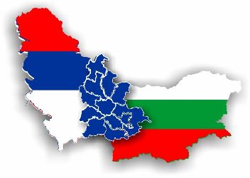
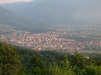
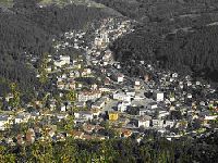
Municipality Surdulica is located in the southeast of Serbia , within Pcinja district. It adjoins the Municipality Crna Trava in the north, the Municipality Vladicin Han in the west, the Municipalities Vranje and Bosilegrad in the south, as well as the Republic of Bulgaria in the east. It is situated in a pit at 500 meters above the sea level, surrounded with mountains Cemernik, Vardenik and Kukavica. Municipality Surdulica comprises 628 кm 2 and population of 21200 people with 41 settlements, their size being 15,3 кm 2 . |
Surdulica has 39 cadastral municipalities, 25 local communities and 11 local offices. The municipality has three spatial units: fertile field in the southwest with an urban settlement and surrounding villages where the population has been settling, with unfinished irrigation system, highly suitable for vegetable crops, then, hills suitable for fruit growing, as well as mountainous region with meadows and pastures suitable for high-quality cattle breeding. Apart from the fact that it is suitable for high-quality agriculture, Surdulica has a very good potential for the development of tourism- Vlasina Lake , together with the surrounding mountains Cemernik, Vardenik and Plana. Waters represent a particularly valuable potential of Surdulica, which has partly been used (Hydropower system Vlasina 1, 2 and 3, and a water factory “Vlasinka”, producing high-quality mineral water called Vlasinska Rosa); however, there are numerous chances for the development of mini hydropower stations
|
|
Municipality Tran is in the Republic of Bulgaria , situated in the southwest of the country, and it is the seat of the municipality of the same name Tran within Pernik Province . Tran comprises a 573.5 кm 2 -area with 52 inhabited settlements and about 5000 residents, and it represents the third largest municipality in Bulgaria . Municipality Tran extends on the river banks of the Erma River in the area of Znepolje, at 800 meters above the sea level. Tran adjoins Treklano, Breznik , Zemen and Dragoman, and it is at the very border with Serbia . |
Near the town, there is the border crossing Strezimirovci. The town is surrounded with mountains Kitka, Gerk`s stone, Charchalat and Murgovica. The town is 83km west from Sofia , and it is 30 km west from the regional center Pernik. The municipality abounds in beautiful places such as canyon of the Erma River , with steep cliffs and built eco trail, the museum of yoghurt in the village Studen, as well as the museum of ceramics in the village Businci and the carved chapel of St Petka at the very entrance of Tran. Tran has got an extraordinary potential for the development of agriculture on the large fields and pastures, as well as for the development of tourism in beautiful regions of mountains and hills that surround the town, including the riverside of Erma |
|